Introduction
This trip was SB’s idea. Last September we backpacked the Cranberry Lake 50, and SB was keen to get another taste of the Adirondacks. I’d mentioned the idea of walking the nearly 140 miles from Northville to Lake Placid, describing it to him as New York’s version of the Long Trail or the Cohos Trail, and he immediately latched onto the idea. I’d been reading trip reports about this trail for years and had always kept it waaay back on the backburner, because the conditions sounded miserable with minimal payoff (all mud, no summits?!). I warned SB about the mud, the beaver flooding, the river fords, and the blowdowns, but he would not be dissuaded, so we began planning in late spring. In the northeast, my favorite season for longer trips is, without a doubt, late summer/early fall, when the mud has had a chance to dry out, the streams have gone down a bit, and the mosquito pressure moderates. We decided to aim for mid-August, and I recruited my mom to assist with shuttling and resupplies, which is a bit tricky with a small child who still requires a booster seat. The other complicating logistical matter is that it’s almost impossible to predict what sort of mileage a growing child will be capable of from year to year. I knew SB could do ten-mile days, but how many ten-mile days in a row could he do? All I could do was plan for the slowest possible scenario, and if I ended up hauling a couple days of extra food for each section, so be it.
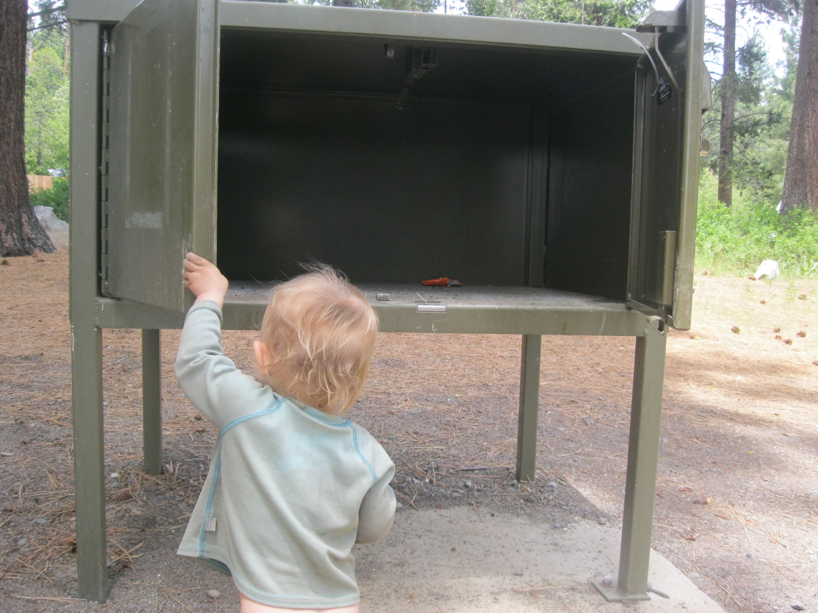
August 14: Northville roadwalk (3.5 miles)
I had a notion, while planning this trip, that it would be nice to try to start in a manageable, relaxed manner rather than our usual hectic approach. Between last-minute packing and the four-hour drive to Northville, I knew I wanted to start with a short day. I booked two nights at the Timeless Tavern in Northville and invited my mom to join us for the first stretch so we could take advantage of having a second car and approach the first section as two point-to-point day hikes. This gave us a crucial bailout option for West Stony Creek, in case we arrived at the river crossing and found it too high to ford. It also meant we could shuttle our car to a trailhead further north to aid with a resupply. It was pretty sweet to be able to “slackpack” the hot, busy roads. Because there’s an ice cream stand conveniently located right next to the NPT wooden arch in Northville, we even bought a strawberry milkshake to slurp on while we walked. Apart from water bottles and phones, it was the only thing we carried.

After our sweaty but leisurely walk, we met my mom at the trailhead on Collins-Gifford Valley Road to get a ride back to town and check into our rooms for the night. Timeless Tavern is a pretty no-frills, hands-off establishment, which I think is perfect for hikers, though other members of the party were less impressed. SB liked that each room has a charming name rather than a room number (we ended up in Golden Paradise, because somebody is obsessed with gold…). And there’s food right downstairs! Since it was a weekend, the dining room was packed, so we had ample time to wander along Main Street and explore while we waited for a table. Northville is one of those uncannily quaint Adirondack towns; the rambling buildings (presumably former hotels and boarding houses) and well-preserved storefronts, including an old Five and Dime, make it easy to imagine Main Street as it might have been a century ago, welcoming tourists from the city arriving by train.
August 15: Collins-Gifford Valley Road trailhead to Benson Road trailhead (8.6 miles)
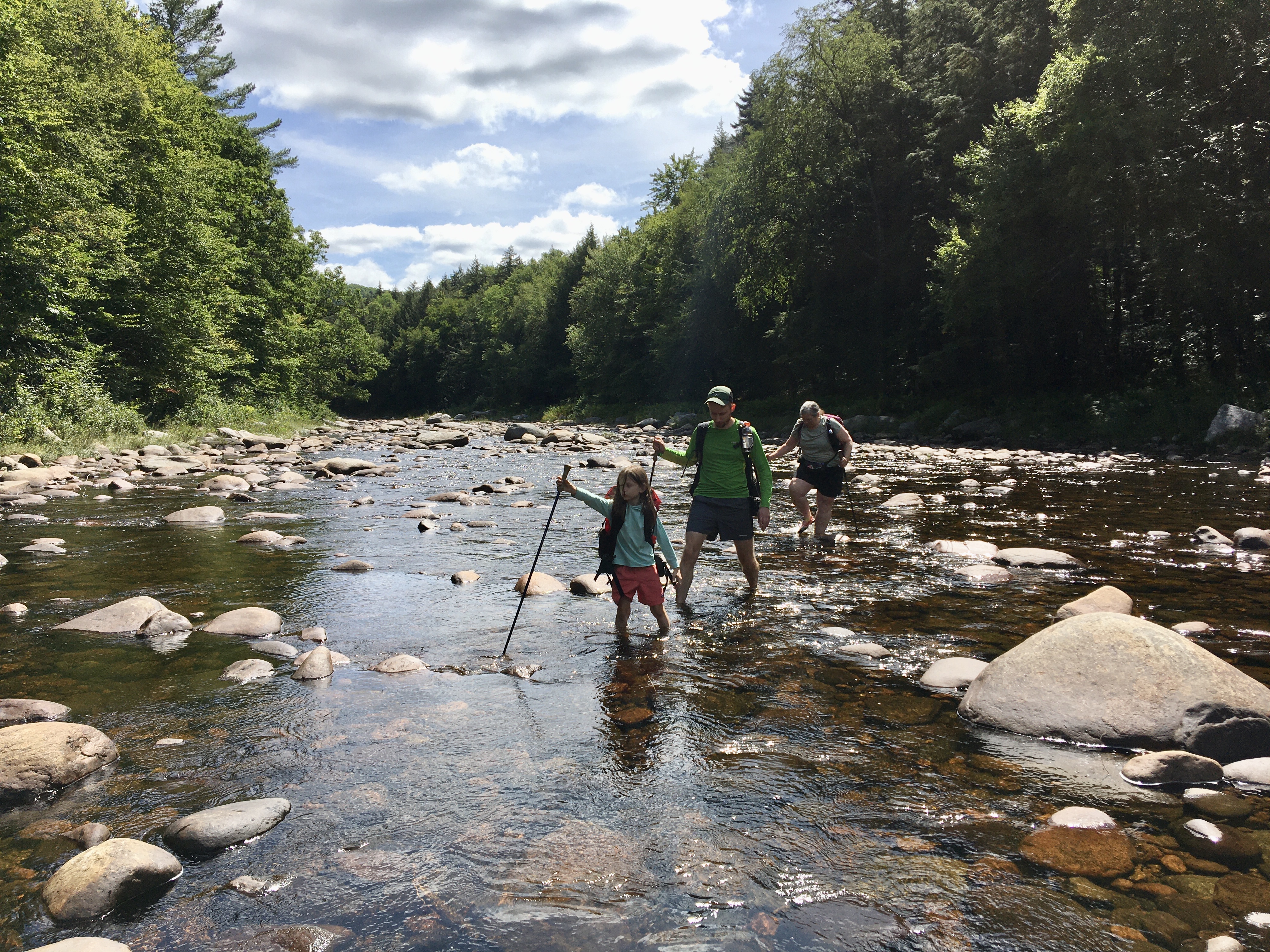
All summer long, I’d been reading NPT trip reports that described waist-deep river crossings and currents so strong adult hikers decided to turn back. July was a monsoon month, full of heavy rain, and I was concerned that the West Stony Creek ford, only one day into our trip, might be an impossible obstacle. If the water was waist-deep on adults, it would be practically over a seven-year-old’s head! Our best bet, I decided, was to spot one car at the trailhead south of the river crossing, and the other car at the next trailhead north of the river. That way, we’d have the option to turn back or continue forward, depending on the conditions.

The trail through Shaker Mountain Wild Forest is truly beautiful. The woods, due to logging, are open and airy, with the bright, sunlit feel of managed woodland rather than the dark, rugged impenetrability of wilderness areas. We enjoyed a second day of hot, sunny weather, perfect for fording a river. Thanks to the relatively rainless stretch of weather that preceded our trip, we managed to hit West Stony Creek at its lowest water level of the season. The current was still brisk, but with a trekking pole and an adult hand to hold, SB had no trouble with the crossing, which was never deeper than his knees. We made good time on the well-maintained trails, and had plenty of afternoon left to shuttle our car up to Long Lake. The Timeless Tavern dining room is closed on Sundays, so we grabbed some surprisingly decent Chinese takeout down the street and ate it in the park before turning in for the night.
August 16: Benson Road to Silver Lake Lean-to (12.3 miles)
I gave SB two options for our first campsite. We could start easy and hike 9.8 miles to the shore of Rock Lake, or we could push ourselves a little and hike 12 miles to the lean-to on Silver Lake. With a reasonably early start and the weather on our side, we arrived at Rock Lake in mid-afternoon with no trouble. We spent a leisurely hour basking in the sun and playing in the shallow water. PPL set up his hammock to lounge in, and we cooked an early dinner. Afterwards, we decided we had enough daylight to head on to Silver Lake to set up camp, so we packed up and headed north, playing Twenty Questions the whole way.
At Silver Lake, we met up with several NPT thru-hikers we’d encountered the day before, a group of four guys from Rochester. Three of them had names that started with D and were carrying ULA packs; the fourth, Sam, carried a towering 65-lb pack. He told us he’d packed in fresh steaks and corn on the cob for dinner the first night, and offered SB a taste of his homemade venison jerky. Another thru-hiker, a woman named Shira, had checked the forecast on her inReach and warned us that there was rain on the way in the morning. The others were planning on getting up before dawn to make sure they had everything packed before the storm rolled in. Knowing we are not the earliest of risers, I had a feeling we’d be dealing with a slow, soggy start in the morning.
August 17: Silver Lake to Hamilton Lake Stream Lean-to (11.4 miles)
The rain came as predicted, and I awoke to light pattering before dawn. The cloud cover made it hard to tell how early or late it actually was, but I heard stirring from the other groups’ campsites, so I guessed it couldn’t be unreasonably early. The rain intensified steadily with now signs of abating, so I suited up and got ready to prepare breakfast in the lean-to. Thank goodness for shelters! I let SB sleep as late as he wanted and read to himself on the Kindle once he woke up, all cozy in the tent. It took a lot of encouragement to get him into his rain gear and out the door.
Before long, the steady rain turned into sheets — bucketfuls! — of water. We might as well have been walking underneath a waterfall all morning. It didn’t help that the stretch of trail between Silver Lake and the next lean-to at Mud Lake was a mess of blowdowns and detours. Between the ceaseless rain and the fallen trees, this was one of the most challenging stretches of the trip in terms of wayfinding and felt like it took forever. We agreed we would at least take a long rest at the Mud Lake lean-to, if not spend the night, to give ourselves a break from the deluge. At the shelter, we met a section-hiker having a hard time motivating himself to pack up and head out into the rain. We chatted and ate snacks for at least an hour, probably more, waiting and watching for any change in the sky. Eventually, it seemed like the rain was slowing down a bit, and we were getting itchy feet, so we suited back up and decided to push on until we reached the Whitehouse tentsite or the Hamilton Lake Stream Lean-to.

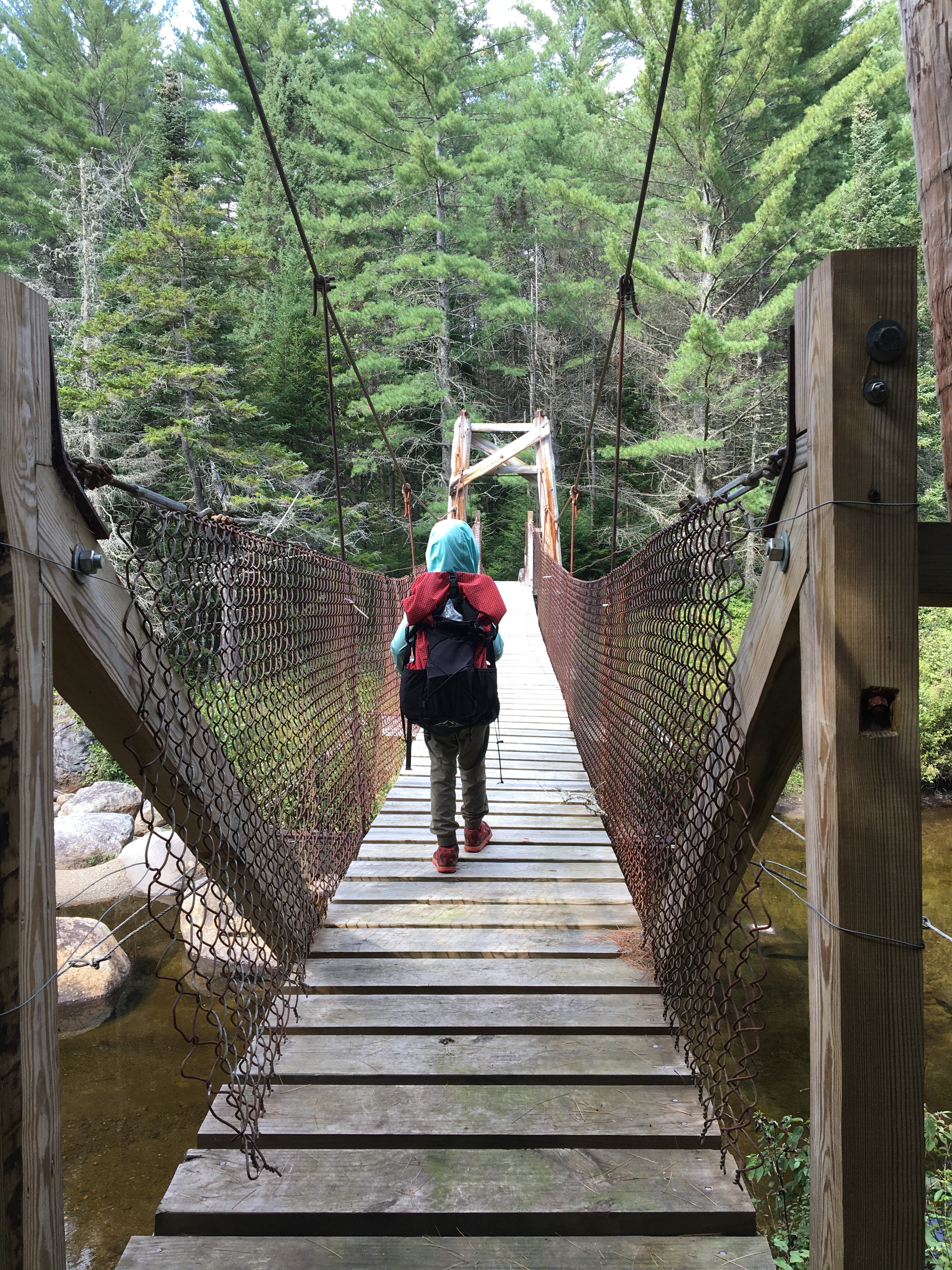
I had a strong suspicion we would go ahead and push for the lean-to, because once you’re sopping wet you might as well keep walking. There were a few tricky stream crossings, and the rickety old suspension bridge over Hamilton Lake Stream, whose missing slats afforded an intimidating view of the rushing water below, was almost too scary for SB to cross. Setting up camp, I discovered that a couple of my oldest dry bags had started to delaminate at the seams and the lower half of my down quilt was sopping wet. Misery upon misery! It was a warm night, so I knew I’d sleep fine, but I also knew that once we arrived in Piseco we’d have to address the gear failures before starting on the next section of trail. I reminded myself that the mail drop I’d sent to the Piseco post office contained some trash bags and plenty of gallon-sized and quart-sized freezer bags, and I slept somewhat better knowing I’d be able to figure out some way to repack the contents of the dry bags.
August 18: Hamilton Lake Stream to Rte 8/Oxbow Motel (3.5 miles)
The rain pounded down on us all night long but the temperature hardly dropped, giving the inside of the tent a rather sauna-like ambiance. PPL, in his hammock, had a much more comfortable night thanks to better airflow. Miraculously, thanks to the warm temperatures and good ventilation, he managed to sleep my wet quilt dry with his body heat. It was perfectly fluffy in the morning! We knew we only had a few miles to go to get to Route 8 and the towns of Piseco and Oxbow, but what we weren’t sure of was where the heck we were going to spend the night. A brief stop in town to grab our mail drop at the Post Office, and then on to the Fall Stream tentsite? With nonstop rain in the forecast and all of the brooks and vleis we crossed rushing along at max capacity — or more — it was hard to imagine a streamside campsite being a good idea.

We decided we should at least check to see if the Oxbow Motel had any rooms available. Between the miserable weather and it being midweek, maybe we’d get lucky. Fate was on our side; the Oxbow had just had a cancellation and we were able to snag a room! Peeling off our wet gear and flopping down in that blissfully dry room was such a relief. Once we were cleaned up, we ordered a big take-out meal from the Oxbow Inn, the hopping restaurant right next door to the motel. Delicious! Nothing better than sitting on the covered patio watching the rain come down, filling up on cold sodas, hot pizza, and fish and chips. The motel’s new proprietors are wonderful people, friendly to hikers, and clearly very fond of the region. They offered us a ride to the Post Office, so we’d be able to pick up our mail-drop before they closed, rather than having to wait until the next morning. The guests in the neighboring room were friendly as well, and we stayed up late chatting.
August 19: Our first zero (0 miles)
We went to bed not sure if we’d hit the trail in the morning or not. The region was under a flash flood warning due to Hurricane Fred, and we knew we were heading into one of the wettest, most remote sections of the NPT, the West Canada Lakes Wilderness. Moreover, SB had developed a rash the evening before that showed no signs of clearing up. Instead, it was spreading. At first, I thought it might be a heat rash from spending two days inside clammy rain gear. I didn’t want to bundle him back up in his grubby synthetic clothes if it was irritating his skin. The rash wasn’t itchy and didn’t seem to bother him, but it bothered me to not know what was causing it, and whether it might signal a more serious problem. Late that night, it occurred to me that body rash can be a secondary symptom of viral illnesses, including COVID, and PPL and I decided we would need to get SB tested and check in with his doctor before continuing the trip. Even though he was otherwise asymptomatic, we didn’t want to take even the slightest chance that we were spreading the virus, and heading into West Canada Lakes with a sick kid would be unnecessarily risky. SB took it all in stride and seemed happy to hang out in the motel room, explore the grounds trying to spot all the chainsaw carvings of black bears, and eat another hot meal from the Oxbow Inn.
August 20: Heading home (3.2-mile roadwalk)
We’d arranged for PPL to get a ride with Bob of Bob’s Shuttles to retrieve our car from the trailhead in Long Lake. We decided SB shouldn’t ride with anyone else in case he was infectious, so while PPL picked up the car, SB and I completed the three-mile roadwalk along Rte 8, Old Piseco Road, and Haskells Road. This was a more fun way to spend the morning anyway. The weather was beginning to clear, and I was feeling more than a bit of regret about not being back on the trail. We stopped at a cute little picnic table rest area set at the roadwalk’s halfway point, intending to make some coffee and have a snack. We didn’t stay long, because the mosquitoes were more numerous and more vicious than anywhere else along the trail! Coffee cup and energy bars in hand, we hurried along, hoping the hungry insects wouldn’t follow us too far. We beat PPL to the trailhead and had about half an hour to do nothing but sit, drink coffee (me), eat snacks (SB), and watch a road crew with lots of big construction vehicles replacing the Cold Stream bridge at the trailhead. Cold Stream was still churning and frothing along, glutted with rainwater, and from the condition of the banks it looked like it had been running even higher during the previous days.

Intermission: Waiting and debating
We stopped at an urgent care on the way home and waited for an eternity (an hour) for SB to take a COVID test, but it was still faster than scheduling an appointment, which would have meant waiting until after the weekend. I sent a message to SB’s pediatrician as soon as I had decent reception, but since it was already Friday afternoon and not medically urgent, I knew I probably wouldn’t hear anything from them until Monday. I would have to figure out a way to sit still for at least a couple of days, but patience and staying home are not exactly my greatest strengths. On the flip side of my impatience was guilt: was I really more preoccupied with finishing this trip than with my kid’s health? Maybe getting back on the trail was a terrible idea. What if the rash was caused by sweat, or dirt, or polyester?
All the same, it felt somewhat ridiculous to be anxious because SB was in good spirits and brimming with energy. He and PPL were perfectly happy to have a break, play games, eat fresh food, and sleep in cozy beds, while I found myself pacing around like a caged animal. I busied myself repairing and repacking gear, and laying plans for the next section. If we got the all-clear from the doctor, SB and I would hit the road and spend one night at Little Sand Point State Campground in Piseco. This would put us just minutes from the trailhead and enable us to get an early start the next day and hike to Spruce Lake, which looked gorgeous.
Early the next week, SB’s doctor assured us that the rash wasn’t COVID or MIS-C, nor did it appear to be an allergic reaction, and that absent any other symptoms we shouldn’t worry. She told us it was likely the result of some other mild viral infection. Feeling more confident, I got packing, and test results the next day came back COVID negative. SB and I were back in Piseco Tuesday night, almost a full week after we’d arrived there sopping wet in the middle of Hurricane Fred.
August 25: Haskells Road trailhead to Spruce Lake Lean-to #3 (10.5 miles)
SB and I had a smooth first day back on the trail. We were up with the sun and after packing up our campsite at Little Sand Point we were on the trail in a matter of minutes. I was relieved to find the water levels low at both Fall Stream and Jessup River and we had no trouble with either crossing. It was a hot and humid day, so we took a long midday break to splash around in Jessup River before pressing on to Spruce Lake. We made good time and arrived at the first lean-to with plenty of daylight left. We basked in the afternoon sun for quite a while, cooked an early dinner, and played in the water.

I told SB that I’d read the third lean-to had the nicest swimming spot, as well as a nice tent site, so it might be worth hiking the extra mile to go check it out. He was game, so after a leisurely break, we packed up and hit the trail again. We briefly investigated Spruce Lake #2 and were unimpressed by how far away from the shore it was, so we pressed on. When we arrived at #3, we found the lean-to occupied by two thru-hikers, Jeff and Tammy. They were incredibly friendly and SB was friendly right back, sharing his usual onslaught of elaborate stories and miscellaneous facts. We enjoyed a second swim and dessert (lollipops, because it was too hot to even consider drinking cocoa) before settling in for the night, listening to loons calling out to one another across the lake.

August 26: Spruce Lake to Beaver Pond/Cedar Lake Lean-to #2 (11.7 miles)
After yet another hot, muggy night we got ourselves up and out reasonably early. SB is not much of a morning person, but when it’s just me and him, I can get us ready to go pretty efficiently, finishing my coffee and breakfast while he’s still asleep and packing up the tent once he’s up and eating his oatmeal. After the somewhat civilized woods between Piseco and Spruce Lake, things started to feel more wild as we headed deeper into West Canada Lakes Wilderness.

We hit a couple of tricky river crossings and encountered one truly awful mud pit between West Lake and Mud Lake (aptly named!). I found myself thigh-deep in muck with both shoes stuck tight, and realized immediately I’d have to grab SB and sling him across before he got stuck too. Once I’d hoisted him onto a dry boulder, I gingerly lifted one foot and then the other, pointing my toes down into the mud and hoping my flimsy little Dirty Girl gaiters would be enough to keep my shoes from getting sucked right off my feet.


We made it out, filthy but unscathed, and had a long chat about what the expression “Type Two Fun” means. I was once again grateful that our day’s destination, Beaver Pond/Cedar Lakes #2 Lean-to, was situated on a gorgeous shoreline where we could rinse off the day’s sweat and mud.
August 27: Cedar Lake to Cedar River Road DEC tentsite (11 miles)
I was awakened before dawn by a flock of Canada geese putting up an enormous racket as they flew back and forth across Cedar Lake, splashing down and honking to one another. SB, of course, slept blissfully through the clamor. Despite the muggy heat, I couldn’t help but think autumn thoughts and felt more driven than ever to get on the trail and keep moving. My goal was to make it at least to Wakely Dam, but I wanted to arrive early enough to have the option to keep going if need be. Since it was a glorious, sunny Friday, I was a little concerned that every dam campsite (heh) would be claimed by car campers.

My concerns were not unfounded; The recreation area was rumbling with generators and motorboats when we arrived mid-afternoon. SB, a budding engineer, was very excited to investigate the dam and I was eager to squeeze in a quick dunk. Afterwards, we searched high and low for the spring described in the guidebook, but couldn’t find anything near the ranger’s cabins or nearby campsites that looked remotely like a water source. There were, however, an astonishing number of old privies scattered throughout the woods, making me hesitant to scoop any nearby water!
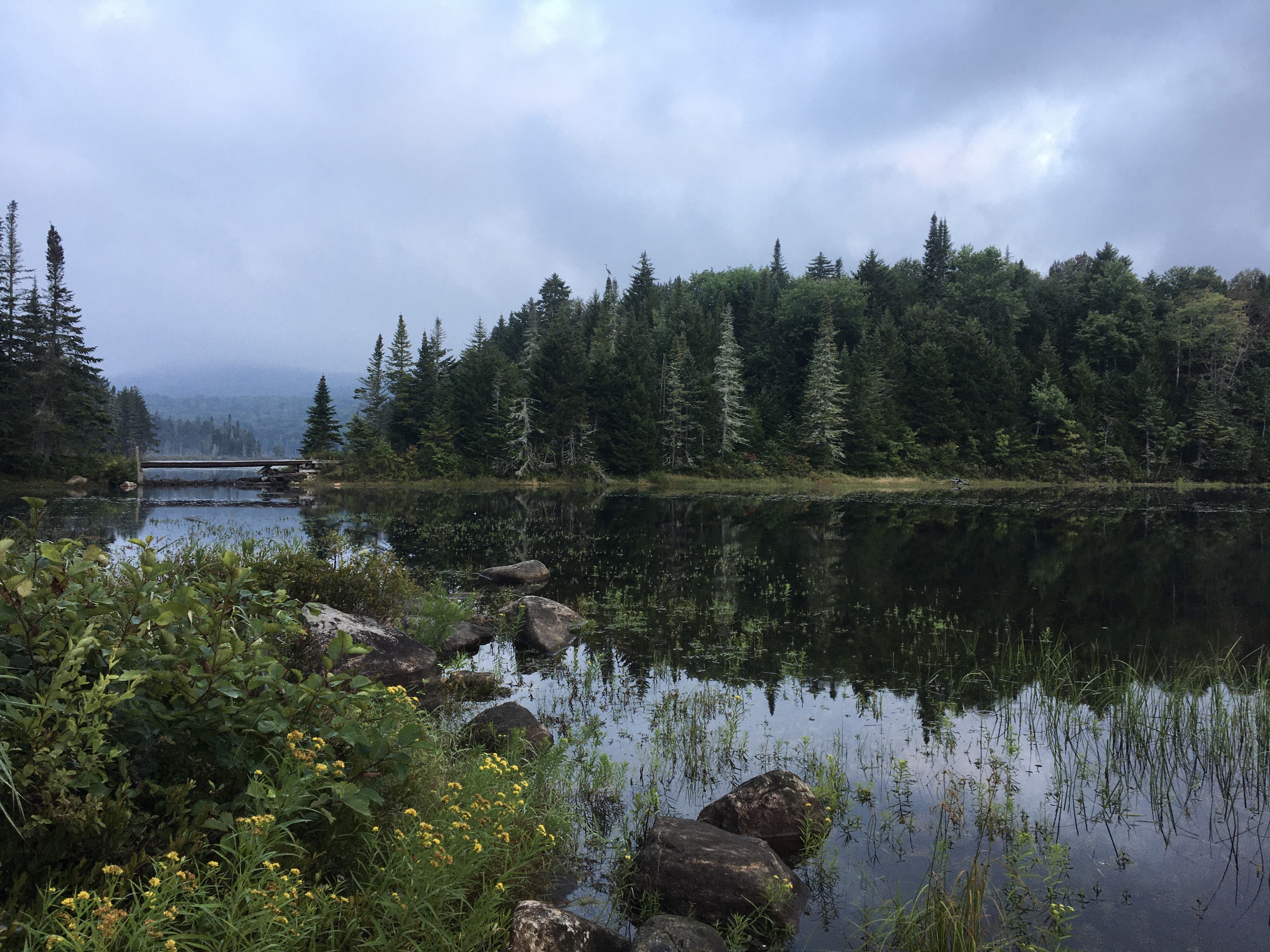
Wakely still had one or two campsites available, but they were completely unshaded. Between the constant noise and the blazing sun, I convinced SB we’d be better off heading down the road to find the Gould Road tentsite. Even before we made it that far, we came across a nice big DEC designated campsite right next to Wakely Pond on Cedar River Road.

The peaceful pond and the sweet little boardwalk along its shore beckoned us, so we decided to set up camp. Then we wandered down Cedar River Road a bit further to find the turn-off for Gould Road and make sure we knew where we headed in the morning. Several car campers stopped by to check out the area; all of them seemed surprised to find a campsite there, as it doesn’t seem to be indicated on any maps.

August 28: Cedar River Road to Lake Durant State Campground (11.6 miles)
SB and I were pretty excited to be sticking to our schedule, cranking out some miles, and staying relatively dry. The woods walk heading north from Wakely Dam is pretty uneventful — borderline monotonous — but on the NPT we don’t complain about such things, because at least we’re not swimming through mud! Our plan for the day was to meet PPL at Lake Durant State Campground on Rte 28/30, spend the night there, resupply, and take a few hours to shuttle our car from where we’d left it at the Piseco trailhead up to Lake Placid before starting the Tirrell Pond section. The thought of a managed campground with showers, laundry, a beach, and takeout food just a short drive away, not to mention getting to hang out with Papa and the dog, had us feeling quite peppy and eager to reach our destination. We made good time in the morning, stopping for lunch at Stephens Pond Lean-to (the trail near Stephens Pond was the first and only muddy stretch of the day). Civilization started to feel especially close when we met three day hikers who’d hiked in from Lake Durant hanging out at Stephens Pond. We hardly saw any day use on the NPT as most of the scenic destinations are quite far from the trailheads and there are zero peaks to bag.

We beat PPL to Lake Durant by a couple of hours and SB had a great afternoon playing on the beach with a group of kids staying at the campground on a family vacation. The temperature had dropped significantly overnight and all day long the sky has been full of stubborn stratus clouds that refuse to burn off. The air felt about twenty degrees cooler than what we’d grown accustomed to over the past three days. I could feel autumn on its way. Once PPL arrived, we set up our campsite and drove down to Piseco to grab the car we’d left there on Wednesday. Then we spent a spectacularly long time waiting for mediocre take-out pizza in Indian Lake, which we took back to Lake Durant to eat in the drizzly dark at our campsite.

August 29: Lake Durant to O’Neill Flow Lean-to (3.5 miles)
Knowing that our day would begin with a long drive up to Lake Placid and then back to Lake Durant, my goal for the day was simply a leisurely stroll to Tirrell Pond. Between Tirrell Pond and Long Lake, camping options are extremely limited (just some tenting near Salmon River), so I didn’t feel tempted to push any further than Tirrell Pond Lean-to. The biggest ascent and descent of the trip would be the next day, climbing the shoulder of Blue Mountain, followed by a paved uphill roadwalk on Tarbell Road. A restful nearo, I hoped, would put us in a good position for the upcoming challenges. We had a great grab-and-go breakfast of bagels and coffee cake from the Corner Store at Blue Mountain Lake, much quicker and more satisfying than our dinner the night before.
We drove in and out of drizzly cloudbanks all morning, which didn’t bode well for the afternoon. Maybe the clouds would burn off and the rain would dry up by the time we hit the trail? But we couldn’t expect the weather to cooperate all the time. We barely managed to hike a few tenths of a mile before the sky opened up for real and we had to scramble into our full rain gear. Once you’re soaked, there’s nothing to do but keep moving, so we bid Papa and the dog farewell (they’d decided to accompany us for a bit to stretch their legs), and trudged along toward Tirrell Pond.
We reached the O’Neill Flow Lean-to before we knew it. We thought for sure the lean-to would be full of people, judging by the herd of rowboats and canoes pulled up on the sandy shore of Tirrell Pond, but we couldn’t find a soul anywhere. Once we arrived, there was nothing I could do to convince SB to take another step, so we relaxed and dried off under the lean-to roof, watching the rain pound down and eventually taper off. I went to investigate the mystery boats and discovered that they belonged to a float plane company; the NPT guidebook does mention that people hire float planes to fly them into Tirrell Pond for fishing trips. This also explained, to some extent, the half-empty liquor bottles, honey jars, and other food-related junk lying around the shelter. Most of the NPT lean-tos we camped at felt quiet, remote and relatively clean, while both shelters on Tirrell Pond gave me the distinct impression that they see a good deal more use, not all of it responsible.

August 30: O’Neill Flow to Catlin Bay (13.1 miles)
I knew, having checked the forecast the day before, that there was a good chance we’d get some more rain in the morning. We packed up quickly and tried to take advantage of whatever dry weather we could get. It was raining before we knew it, so we resigned ourselves to another day of muddy trudging. It was only a mile or so to the next lean-to on the north end of Tirrell Pond, but we were plenty ready for a break, so we stopped to take advantage of the roof and dig out some snacks. We met two section hikers and their adorable dog, Nola, at the lean-to. They were clearly having a hard time getting motivated to head out into the rain!

Since SB and I had quite a few miles left to make it to Long Lake, we kept our break short and pushed on despite the dreary weather. It wasn’t too long before a group of four moving at a brisk pace breezed by us. We never saw the two guys from the shelter again, but we would play leapfrog with the group of four all the way to Cold River. The climb up Blue Mountain didn’t strike me as terribly burly, even hauling a five-day resupply for two. One of the perks of training in the White Mountains is that SB and I know a thing or two about steep. In SB’s opinion, “This is nothing compared to Doublehead!” By the time we crested the ridge, the clouds had started to lift and we were getting glimpses of the sun. This, along with a lot of Goldfish and some Snickers bars, gave us the boost we needed to keep going. The day wasn’t over, but the afternoon felt more manageable with the sun burning through. We crossed a series of slippery bog bridges that felt like they would go on forever and reminded us of the Cohos Trail, and then began our second grueling climb of the day, up the steaming asphalt of Tarbell Road. We took a quick break at the Tarbell Road parking area, but we were eager to find Long Lake and, we hoped, snag a glorious shoreline campsite.

Once we were off the road and back on the trail, the short stretch to Catlin Bay felt effortless. The afternoon sun and the brisk breezes made the west-facing bay the perfect place to spend the rest of the day. Instead of staying up at the shaded lean-to, we walked along the shore and investigated the tent sites to find the one with the nicest “beach” to relax on. While SB tossed rocks and played with some beach toys abandoned by previous campers, I spread out every single piece of our soggy gear on the sand, confident that I’d have everything blissfully, gloriously dry by the time the sun set. I couldn’t believe our good fortune, and this was easily my favorite campsite of the entire trip. It certainly didn’t hurt that Long Lake was the perfect temperature for swimming!

August 31: Catlin Bay to Miller’s Falls (14.7 miles)
I’d spent the entire trip looking forward to the Cold River section and it did not disappoint. We spent the morning moseying along the shore of Long Lake, stopping for breaks at most of the shoreline lean-tos. Overnight, the calendar had flipped from August to September and the weather had shifted accordingly. The air was brisk and we finally had the opportunity to make use of our insulating layers. It’s exciting to put on gloves and a Buff for the first time when they’ve been languishing inside your pack, adding pointless weight, for days. The speedy group of four passed us early in the day, so we guessed (correctly) that they’d stayed in the town of Long Lake the night before. I wondered how many NPT thru-hikers skip the beautiful Long Lake shoreline sites in favor of a hotel room, and was glad our itinerary had afforded us such a pristine late-summer evening to swim, listen to the loons, and watch the sunset across the bay.
The mud and wet on the northern leg of the journey felt tame compared to West Canada Lakes and the monsoon days between Northville and Piseco, and we reached the trail junction at Shattuck Clearing earlier than we expected. Crossing the dramatic suspension bridges over Moose Creek and Cold River was a delight — the two best bridges of the whole trip, according to SB — and the riverside “tote roads”, as the guidebook calls them, were some of the most pleasant walking we experienced during the entire trip. We caught up with the group of four at the first Cold River lean-to and took a nice long snack break there to explore the boulders along the river bank, cool our feet, and enjoy the view of the rushing cascades.

I told SB we could stay there for the night and easily finish the day after next, but he’d slated this as his “biggest day yet” and was determined to do the extra miles to Miller’s Falls (Seward Lean-to) for a daily total of 14.7 miles, his longest single day of hiking ever. It was still early, and I am always game for a few more miles, so I followed his lead and off we went. After lots of rugged ups and downs, we arrived at Miller’s Falls in the late afternoon and had a great time basking on the sunny rocks, watching the river tumble by. The water and the air were almost too chilly for a dip, but I couldn’t resist. As much as I loved this campsite, it was also one of the most anxiety-inducing for me as a solo parent; camping right next to a deep river with a strong current with a kid who isn’t a confident swimmer requires constant vigilance.

September 1: Miller’s Falls to Wanika Falls (13.5 miles)
Our second-to-last day went by in a blur. I fully expected to see the group of four that we’d passed at Cold River, but they never overtook us. The going was a bit slower than we expected along the Roaring Brook section, which was full of blowdowns and eroded by high water. On the bright side, none of the wet areas were as wet as we anticipated, and we spent most of the day with dry feet.

I had presented SB with two options for the night: Moose Pond Lean-to or the Wanika Falls tentsite. He liked the idea of doing the longer day to Wanika, but was also disappointed that there would be no lean-to to play in that night. I strengthened the case for Wanika by telling him that if we hiked the extra miles, we’d reach the terminus before lunchtime the next day and we could eat whatever kind of yummy food he wanted once we were in Lake Placid. No more boring tortillas-and-PB! That was motivation enough, even to scale the steep and somewhat overgrown 0.2-mile side trail to the campsite, a clearing where there used to be a lean-to, above the falls. The NPT guidebook fails to note that to reach the campsite at the end of the spur trail, it’s necessary to cross the river just above the falls. I’m not sure what that crossing would look like during times of high water or heavy rain and I was glad I didn’t have to find out.
September 2: Wanika Falls to Averyville Road (6.5 miles)
North of Wanika Falls, the trail became pretty uneventful and the sense of the trip winding down was palpable. We brainstormed our celebratory town meal (bagels? ice cream? Chinese? Indian?) and giggled at the many bridges on this stretch that crossed bone-dry gullies. We could’ve used some of those bridges further south! SB was very motivated to reach the terminus and we hiked pretty much nonstop the whole morning, with only brief breaks for snacks and water. Despite my efforts to build a lot of variety into our trail diet, we were both getting bored with most of our options at that point. I ate the last of my fig bars and shortbread, while the only things that still held SB’s interest were Goldfish, Welch’s fruit snacks, and Snickers (pure salt and pure sugar!).
Once we neared Averyville Road, I decided to check my phone for LTE, recalling that I’d had pretty good signal when we dropped the car off. We were able to make ecstatic video calls to our family at home as we wrapped up the hike. The video chats chewed through my carefully preserved phone battery almost instantly, but for once it didn’t matter. We loaded up quickly, and charged the phone just enough to get a final photo at the terminus. SB was so impatient for lunch (and home!) that I could barely convince him to grab a quick selfie with me in front of the trailhead sign.

Walking the streets of Lake Placid on a quest for bagels and coffee was a complete sensory overload: The crowds! The traffic! The construction! SB told me he vastly preferred Northville over Lake Placid, a feeling compounded when we discovered the bagel shop had changed its hours without updating them on Google, and had closed just minutes before we arrived! There were a multitude of other food options, but we still felt betrayed.
Even worse, once we were finally on the road home, we got stuck behind a highway crew repainting lines. It’s hard to make a car ride feel slow to a backpacker, but that paint truck, doing 10 mph on a highway posted 55, managed to achieve the impossible. Once we were free of the road crew, the rest of the drive, complete with maple creemees and Indian takeout, was a breeze. And no matter how many trips I take, there is nothing that compares to the feeling of that first hot shower back at home. SB, on the other hand, would have been quite content to remain filthy and feral for a while longer. Ponds and lakes are better than any bathtub!
Check back soon for a follow-up post with some takeaway thoughts on gear, meals, logistics, luxury items, and more.